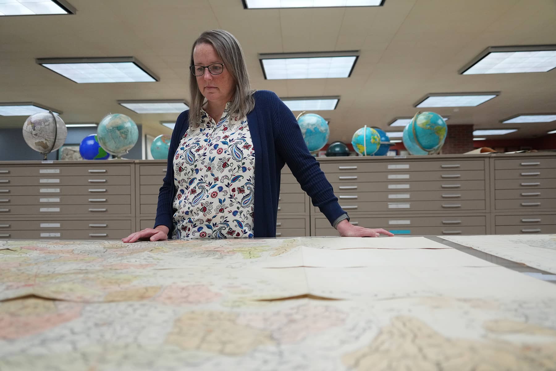


The American Geographical Society Library (AGSL) at the University of Wisconsin-Milwaukee is home to an invaluable historical artifact: the Daedong Yeojido, or the “Territorial Map of the Great East,” created in 1861 by the renowned Korean geographer Kim Jeong-ho.
Alongside a remarkable collection of photographs and documents from George C. Foulk, the map offers a rare glimpse into Korea’s rich cultural and cartographic history.
Kim Jeong-ho’s Daedong Yeojido is a monumental work, both in its physical dimensions and its historical significance. Measuring nearly 13 feet wide and 20 feet in length when fully displayed, the map consists of 22 sheets designed to be folded accordion-style for ease of use.
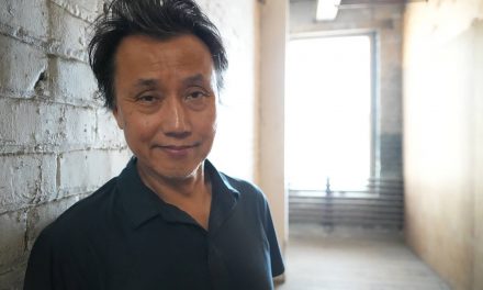
“Koreans consider this map a national treasure, which is why we make it accessible to any Korean Americans or Korean nationals who want to see it. We will always take it out for them,” said Marcy Bidney, Associate Director for Distinctive Collections and Curator of the American Geographical Society Library (AGSL). “It’s very rewarding to watch them view the map, because they understand its history and value. They’re so enamored by it and so excited to see it.”
The map’s scale, approximately 1:162,000, and its intricate woodblock print method highlight Kim’s extraordinary skill and dedication. The map also includes two inset depictions of Seoul and Pyongyang, along with various texts and diagrams, showcasing the advanced geographical knowledge of the time.
“In order to produce the map, a woodblock had to be carved for every section. So the amount of work, time, and energy that went into creating it makes it really special. Otherwise, It could have been drastically smaller, just one block of wood with the whole of Korea on that one block of wood,” said Bidney. “The labor-intensive process of making a map this big was very rare for its time. The details are also why it is a significant piece of cartographic history.”
The production of such a cartographic milestone required substantial resources. Kim’s map necessitated 120 woodblocks, each measuring about 12 by 16 inches. The considerable investment in carving, storing, labor, and tools indicates a high demand and steady market for the map, possibly commissioned by royalty for specific purposes.
As a cartographer and printer, Kim produced a complete atlas of Korea in 1834. After a 27-year absence from the historical record, he reemerged in 1861 with the Daedong Yeojido, a significant revision of his earlier work.
It is believed that Kim traversed the length and breadth of Korea multiple times to gather data for this map. His meticulous work improved measurement techniques, refined coastlines, revised place names, added or deleted cultural features, and included military sites.
The map also features topographic symbols, with thin black lines indicating gentler mountains and thicker lines representing higher elevations. For distance, a black tick marks every 10-li, approximately 24.4 miles, and denotes road distances – which enhanced the map’s practical utility.
The map is written with Chinese characters and not Hangul, despite Korea having its own writing system since the 15th century. Known as Hanja, Chinese characters were associated with scholarship, administration, and the classical literary tradition. Hangul’s use gradually expanded over time, but it did not fully replace Hanja until the 20th century.
The map’s rarity is further underscored by being one of only a few large-scale maps of Korea from that period. AGSL’s copy is also the only known version that includes color.
The AGSL’s copy of the Daedong Yeojido was once owned by George C. Foulk, a U.S. Naval attaché to Korea from 1884 to 1887. An adventurous and dedicated diplomat, Foulk had a profound impact on U.S.-Korean relations during his tenure.
His collection of maps and photographs, acquired by the AGSL in 1895, offers the Milwaukee public invaluable insights into Korean culture and geography of the late 19th century.
Foulk’s journey to Korea began in 1883 when he accompanied a Korean delegation to the United States as the only U.S. government official qualified to serve as an interpreter. Although not fluent in Korean initially, he communicated in Japanese and quickly learned Korean.
Upon his arrival in Korea, Foulk embarked on a 900-mile journey through the country by sedan chair, meticulously documenting his travels in a detailed journal and capturing numerous photographs.
His time in Korea was marked by significant events, including an unsuccessful coup d’état in December 1884. Despite the tumultuous political climate, Foulk’s friendship with King Sunjong, later Emperor of Korea from 1907 to 1910, granted him unique access to photograph Korean life and interact with the royal family.
Foulk’s dedication to documenting Korea is evident in his extensive collection of photographs, which include scenes of daily life and important cultural landmarks.
The 43 photographs taken by George C. Foulk between 1884 and 1885, now housed at the AGSL, provide an intimate look at Korean society during that era. The images include portraits of Korean officials, such as the governor of Chula province, as well as scenes like archery drills at Puk-Han Mountain Fortress, and kisaeng women performing traditional drum dances.
One particularly striking photograph shows a group of Korean and American diplomats, including Prince Min Yong Ik, minister plenipotentiary. The image, along with Foulk’s detailed notes identifying each individual, highlighted the diplomatic exchanges between Korea and the United States during the late 19th century.
Another notable photograph featured King Kojong of Korea on his throne at the age of 30. King Kojong, the 26th king of the Choson Dynasty, was crowned in 1864 and declared himself emperor in 1897. He was forced to abdicate by the Japanese in 1907 and died in 1919. Foulk’s close relationship with the king provided him with unique opportunities to record the intimate portraits.
AGSL has meticulously preserved the Daedong Yeojido and other artifacts from the Foulk collection since acquiring them in 1895. The map and photographs have been carefully maintained, ensuring that the public can appreciate and study the important cultural treasures.
The American Geographical Society (AGS) was founded in 1851 to research, discover, chart, and understand unknown regions of the Earth. The current library was created in 1978, when two collections were moved from New York City to their new home in Milwaukee. AGS still exists as an organization, but the library is wholly owned and operated by the University of Wisconsin-Milwaukee.
“We have some of the maps that Charles Lindbergh used when he was plotting the course for his solo flight across the Atlantic Ocean, from St. Louis to Paris. Those get viewing requests fairly often,” added Bidney. “Then we have maps drawn by Captain Cook from his first expedition to explore Australia. Researchers often want to see those a lot also.”
In November 2009, the AGSL hosted a symposium featuring Korean scholars who discussed the significance of the Daedong Yeojido. The event renewed attention of the map’s enduring value as a historical and cartographic masterpiece. The symposium also provided a platform for scholars to share insights and explore the map’s contributions to the understanding of Korea’s geographical and cultural heritage.
The collection of artifacts, all stored in Milwaukee, continues to be studied and offers a bridge to the past for contemporary audiences to appreciate the depth and richness of Korea’s historical landscape. The AGSL’s dedication to maintaining and showcasing the treasures ensures that the legacy of Kim Jeong-ho and George C. Foulk will endure for generations to come.


MI Staff (Korea)
Lее Mаtz
Library Of Congress, American Geographical Society Library (AGSL), and University of Wisconsin-Milwaukee Libraries
- Exploring Korea: Stories from Milwaukee to the DMZ and across a divided peninsula
- A pawn of history: How the Great Power struggle to control Korea set the stage for its civil war
- Names for Korea: The evolution of English words used for its identity from Gojoseon to Daehan Minguk
- SeonJoo So Oh: Living her dream of creating a "folded paper" bridge between Milwaukee and Korean culture
- A Cultural Bridge: Why Milwaukee needs to invest in a Museum that celebrates Korean art and history
- Korean diplomat joins Milwaukee's Korean American community in celebration of 79th Liberation Day
- John T. Chisholm: Standing guard along the volatile Korean DMZ at the end of the Cold War
- Most Dangerous Game: The golf course where U.S. soldiers play surrounded by North Korean snipers
- Triumph and Tragedy: How the 1988 Seoul Olympics became a battleground for Cold War politics
- Dan Odya: The challenges of serving at the Korean Demilitarized Zone during the Vietnam War
- The Korean Demilitarized Zone: A border between peace and war that also cuts across hearts and history
- The Korean DMZ Conflict: A forgotten "Second Chapter" of America's "Forgotten War"
- Dick Cavalco: A life shaped by service but also silence for 65 years about the Korean War
- Overshadowed by conflict: Why the Korean War still struggles for recognition and remembrance
- Wisconsin's Korean War Memorial stands as a timeless tribute to a generation of "forgotten" veterans
- Glenn Dohrmann: The extraordinary journey from an orphaned farm boy to a highly decorated hero
- The fight for Hill 266: Glenn Dohrmann recalls one of the Korean War's most fierce battles
- Frozen in time: Rare photos from a side of the Korean War that most families in Milwaukee never saw
- Jessica Boling: The emotional journey from an American adoption to reclaiming her Korean identity
- A deportation story: When South Korea was forced to confront its adoption industry's history of abuse
- South Korea faces severe population decline amid growing burdens on marriage and parenthood
- Emma Daisy Gertel: Why finding comfort with the "in-between space" as a Korean adoptee is a superpower
- The Soul of Seoul: A photographic look at the dynamic streets and urban layers of a megacity
- The Creation of Hangul: A linguistic masterpiece designed by King Sejong to increase Korean literacy
- Rick Wood: Veteran Milwaukee photojournalist reflects on his rare trip to reclusive North Korea
- Dynastic Rule: Personality cult of Kim Jong Un expands as North Koreans wear his pins to show total loyalty
- South Korea formalizes nuclear deterrent strategy with U.S. as North Korea aims to boost atomic arsenal
- Tea with Jin: A rare conversation with a North Korean defector living a happier life in Seoul
- Journalism and Statecraft: Why it is complicated for foreign press to interview a North Korean defector
- Inside North Korea’s Isolation: A decade of images show rare views of life around Pyongyang
- Karyn Althoff Roelke: How Honor Flights remind Korean War veterans that they are not forgotten
- Letters from North Korea: How Milwaukee County Historical Society preserves stories from war veterans
- A Cold War Secret: Graves discovered of Russian pilots who flew MiG jets for North Korea during Korean War
- Heechang Kang: How a Korean American pastor balances tradition and integration at church
- Faith and Heritage: A Pew Research Center's perspective on Korean American Christians in Milwaukee
- Landmark legal verdict by South Korea's top court opens the door to some rights for same-sex couples
- Kenny Yoo: How the adversities of dyslexia and the war in Afghanistan fueled his success as a photojournalist
- Walking between two worlds: The complex dynamics of code-switching among Korean Americans
- A look back at Kamala Harris in South Korea as U.S. looks ahead to more provocations by North Korea
- Jason S. Yi: Feeling at peace with the duality of being both an American and a Korean in Milwaukee
- The Zainichi experience: Second season of “Pachinko” examines the hardships of ethnic Koreans in Japan
- Shadows of History: South Korea's lingering struggle for justice over "Comfort Women"
- Christopher Michael Doll: An unexpected life in South Korea and its cross-cultural intersections
- Korea in 1895: How UW-Milwaukee's AGSL protects the historic treasures of Kim Jeong-ho and George C. Foulk
- "Ink. Brush. Paper." Exhibit: Korean Sumukhwa art highlights women’s empowerment in Milwaukee
- Christopher Wing: The cultural bonds between Milwaukee and Changwon built by brewing beer
- Halloween Crowd Crush: A solemn remembrance of the Itaewon tragedy after two years of mourning
- Forgotten Victims: How panic and paranoia led to a massacre of refugees at the No Gun Ri Bridge
- Kyoung Ae Cho: How embracing Korean heritage and uniting cultures started with her own name
- Complexities of Identity: When being from North Korea does not mean being North Korean
- A fragile peace: Tensions simmer at DMZ as North Korean soldiers cross into the South multiple times
- Byung-Il Choi: A lifelong dedication to medicine began with the kindness of U.S. soldiers to a child of war
- Restoring Harmony: South Korea's long search to reclaim its identity from Japanese occupation
- Sado gold mine gains UNESCO status after Tokyo pledges to exhibit WWII trauma of Korean laborers
- The Heartbeat of K-Pop: How Tina Melk's passion for Korean music inspired a utopia for others to share
- K-pop Revolution: The Korean cultural phenomenon that captivated a growing audience in Milwaukee
- Artifacts from BTS and LE SSERAFIM featured at Grammy Museum exhibit put K-pop fashion in the spotlight
- Hyunjoo Han: The unconventional path from a Korean village to Milwaukee’s multicultural landscape
- The Battle of Restraint: How nuclear weapons almost redefined warfare on the Korean peninsula
- Rejection of peace: Why North Korea's increasing hostility to the South was inevitable
- WonWoo Chung: Navigating life, faith, and identity between cultures in Milwaukee and Seoul
- Korean Landmarks: A visual tour of heritage sites from the Silla and Joseon Dynasties
- South Korea’s Digital Nomad Visa offers a global gateway for Milwaukee’s young professionals
- Forgotten Gando: Why the autonomous Korean territory within China remains a footnote in history
- A game of maps: How China prepared to steal Korean history to prevent reunification
- From Taiwan to Korea: When Mao Zedong shifted China’s priority amid Soviet and American pressures
- Hoyoon Min: Putting his future on hold in Milwaukee to serve in his homeland's military
- A long journey home: Robert P. Raess laid to rest in Wisconsin after being MIA in Korean War for 70 years
- Existential threats: A cost of living in Seoul comes with being in range of North Korea's artillery
- Jinseon Kim: A Seoulite's creative adventure recording the city’s legacy and allure through art
- A subway journey: Exploring Euljiro in illustrations and by foot on Line 2 with artist Jinseon Kim
- Seoul Searching: Revisiting the first film to explore the experiences of Korean adoptees and diaspora